

🥷💬
Embrace your inner Knowledge Ninja and conquer the intricacies of topographic maps! It’s time to learn how to read contour lines — the key to unlocking the mysteries of the Earth’s terrain. 🌍⛰️
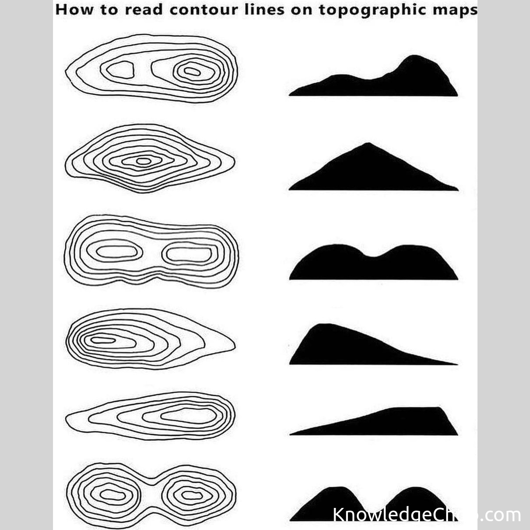
Contour lines are the secret language of topographic maps, revealing the story of elevation changes within the landscape. Each contour line represents a specific elevation, connecting points of equal altitude. Understanding their closeness or distance from each other allows ninjas to decipher the steepness of slopes — close lines imply steep terrain, while farther lines indicate a gentler slope.
The contour interval plays a vital role in interpreting elevation changes. It denotes the vertical difference between contour lines. For example, a 10-meter interval will mean that every line represents a 10-meter elevation change. Lower intervals provide more detail, while higher intervals offer a broader view of the landscape.
By decoding contour lines, the Knowledge Ninja can visualize various terrain features such as hills, valleys, ridges, and watersheds, essential for navigating the great outdoors. With this newfound knowledge, the world is your playground! 🏞️🥷
Put your map-reading skills to the test and adventure like never before! 🗺️🔥
Keywords: set,collection,vector,illustration,design,symbol,nature,image,art,element,disjunct,set up,sign,outline,no person,graphic,chalk out,pattern,wildlife,shape


