

🥷💬
As a Knowledge Ninja, we stride on leveraging every piece of information to achieve our goals. This time, it’s all about mastering the art of reading contour lines on topographic maps! 🗺️⛰️
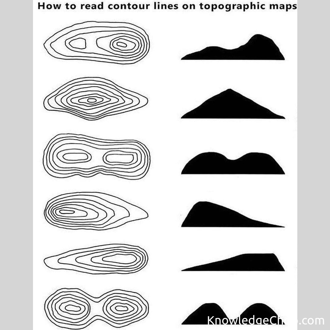
Topographic maps depict Earth’s terrain using contour lines—these lines are like secret codes on a treasure map, guiding you through elevation changes. Remember the ultimate ninja rule: If the contour lines are close together, it indicates a steep slope; if they’re further apart, it’s a more gradual slope.
Understanding the contour interval—the difference in elevation between each contour line—is crucial to determine the steepness of terrains. For instance, if the interval is 20 meters, that means every line represents a 20-meter elevation change. The higher the interval, the more general information given; whereas lower intervals provide more precise details.
In addition to elevation, contour lines also reveal other essential features, such as watersheds and ridges—making your navigation, whether it’s hiking or planning, a breeze. Furthermore, closed contour lines represent peaks or depressions, such as hills and valleys.
Now that you’ve honed your ninja map-reading skills, it’s time to put them into practice in the great outdoors! 🏞️ 🥷
Keywords: set,collection,vector,illustration,design,symbol,nature,image,art,disjunct,element,set up,sign,no person,outline,graphic,pattern,desktop,chalk out,line


